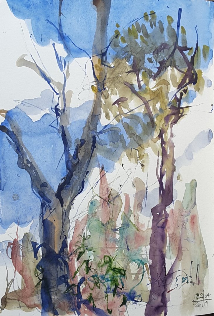
Clouds building up, watercolour, 22 April 2019
Three paintings of gum trees at the Gibraltar Falls picnic area, Easter Monday.

Three young trees, watercolour.
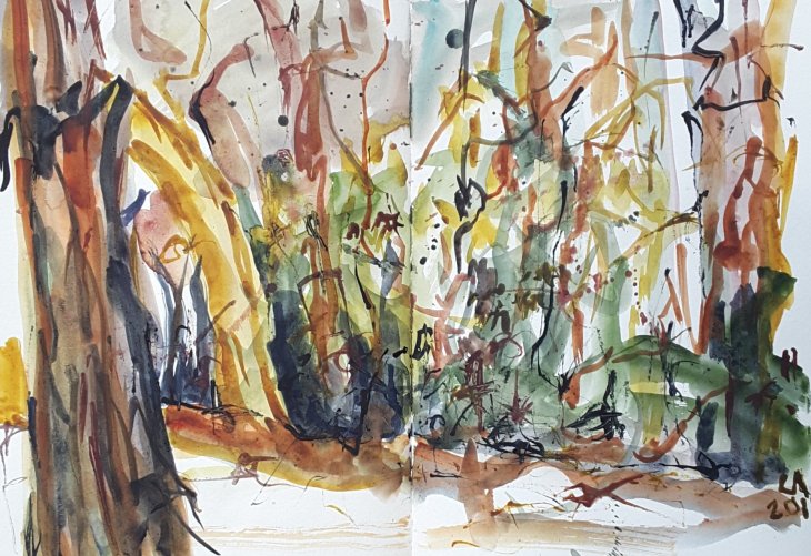
Bushland, watercolour.
Clouds building up, watercolour, 22 April 2019
Three paintings of gum trees at the Gibraltar Falls picnic area, Easter Monday.
Three young trees, watercolour.
Bushland, watercolour.
It has been a thoroughly miserable day here weatherwise. My partner suggested that we get out to have a closer look at the snow falling on the nearby ranges. We drove out to Tidbinbilla Nature Reserve, from where we could see the snow clouds sweeping across the tops of the range. Where we were, on the valley floor, a flock of swallows swooped around our car. I could hardly believe how beautiful it all was.

Snow falling on Tidbinbilla, coloured pencil on toned tan paper
I’m saying that because my drawing was done completely from inside the warmth of our car!
My partner and I have been taking the new online class by Marc Taro Holmes on Travel Sketching. Today we decided to to practice some of the drawing approaches that Marc has been teaching. We headed out to the Tidbinbilla Tracking Station, (otherwise known as the Canberra Deep Space Communication Complex – CDSCC), in the rural part of the Australian Capital Territory, to draw the antennae in their bushland setting.
One of the key techniques we are learning is drawing simplified shapes to quickly gather enough information to capture a scene. This way you can do some drawing and still have sufficient time away from your sketchbook to enjoy your holiday! The goal is to capture basic shapes in one line, or maybe 5 or so lines, which I find quite hard to do.
The ‘blind contour drawing’ I learned at art school tends to be my default position when drawing quickly. It’s actually a good approach, but it’s not quite what Marc is suggesting. The difference with Marc’s approach is that you look frequently at your page as well as your subject and that allows the development of a more accurate outline. If you have time, you can then add further lines and build up your drawing that way. I have worked out that if I think about this as drawing the ‘edges’ then my drawings are more successful. I get less inclined to get bogged down in details along the way. I was pretty happy with this drawing I made of a local convenience store earlier in the day, well except for that very dodgy car welded the side of the building.
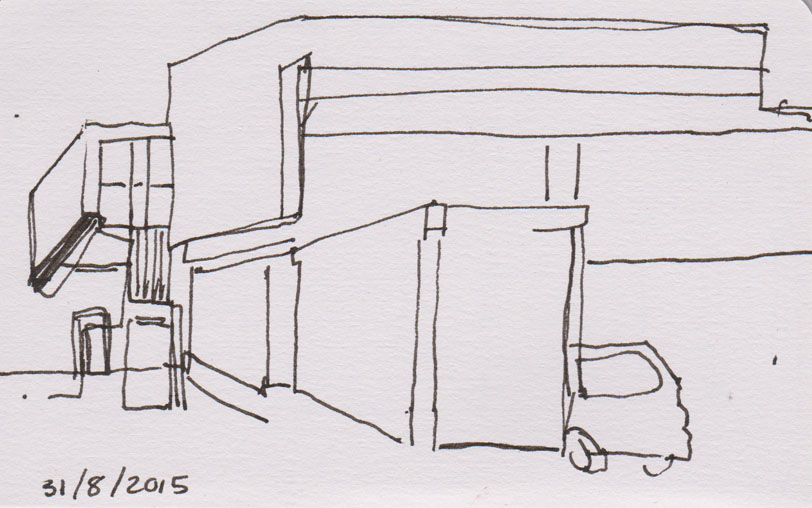
A simplified line drawing in pen and ink, 31 August 2015
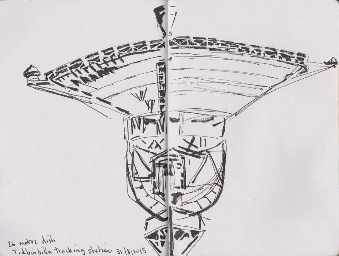
Out at Tidbinbilla there were plenty of interesting subjects to tackle. I settled on the 26 metre dish, or DSS46, (formerly sited at Honeysuckle Creek), that was the antenna that received and relayed to the world the first historic pictures of man walking on the Moon, on Monday, 21st July 1969. As the Centre’s website so eloquently says “DSS46 was retired from service in November 2009 and now remains at CDSCC as celebrated and recognised historic monument.”
While I could hardly describe the following drawing as using one or two lines, it certainly captured the key elements of the scene in front of me with more economy than I usually manage. I will admit though, that I also made several other drawings, which I could only politely describe as being ‘less successful’.
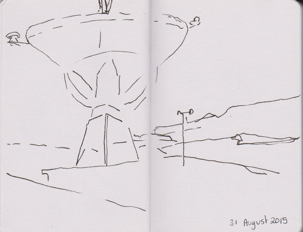
Simplified line drawing of the 26 metre dish, DSS46, pen and ink, 31 August 2015
I liked the scene enough to try a more detailed drawing. Having completed a simplified outline I moved on to providing some solidity with shadow lines drawn with my brush pen. It didn’t take long to realise that the structure of the antenna was such that I’d probably go insane before I could get more than a ‘feel’ for the structure of struts and beams supporting the dish.
The 26 metre antenna,DSS46, line and shadow, pen and ink and brush pen, 31 August 2015
At this point we made a strategic withdrawal to the coffee shop. Of course from the cafe’s deck the 70 metre antenna, DSS43, completely dominated the view – not surprising really as it is the largest single antenna in the southern hemisphere. It’s been busy recently with transmitting commands and receiving data from the Mars Odyssey and the New Horizons Pluto and Charon missions among many others.
I couldn’t resist! With a rapidly cooling cup of coffee I set about doing my final drawing for the day.

DSS43, the 70 metre antenna, pen and ink, brush pen and watercolour, 31 August 2015
We are lucky to have so many interesting places, like the tracking station, to visit within our local area. It’s an amazing combination of leading edge technology in a truly beautiful setting.
It turned out to be a brilliant weekend weather-wise. A perfect pair of Autumn days. Striking blue skies, a crisp temperature of 17C and virtually no wind. So on Sunday we packed some sandwiches and headed out to Namadgi National Park for a spot of bush-walking and painting. Our destination was Mount Aggie, at 1,421 metres (4,662 ft), which sits on the ridge-line which marks the western border between the Australian Capital Territory and New South Wales.

Mountain views, from Mt Aggie, Australian Capital Territory, 17 May 2015
Mt Aggie may not be the loftiest of peaks in the range but it’s summit is readily accessible by a fairly short and easy walking trail. From the top there is a truly panoramic view out over the Bimberi Nature Reserve and Kosciusko National Park and even down to the Bogong Range in Victoria. We were particularly pleased to see a Wedge-tailed Eagle flying overhead shortly after we reached the summit.
We had a great time drawing and only shared the summit temporarily with another small group of walkers. I tried to capture the ridges disappearing into the distance, using the double spread of my Moleskine watercolour book. I think I’d need 3 double pages to capture the full view.
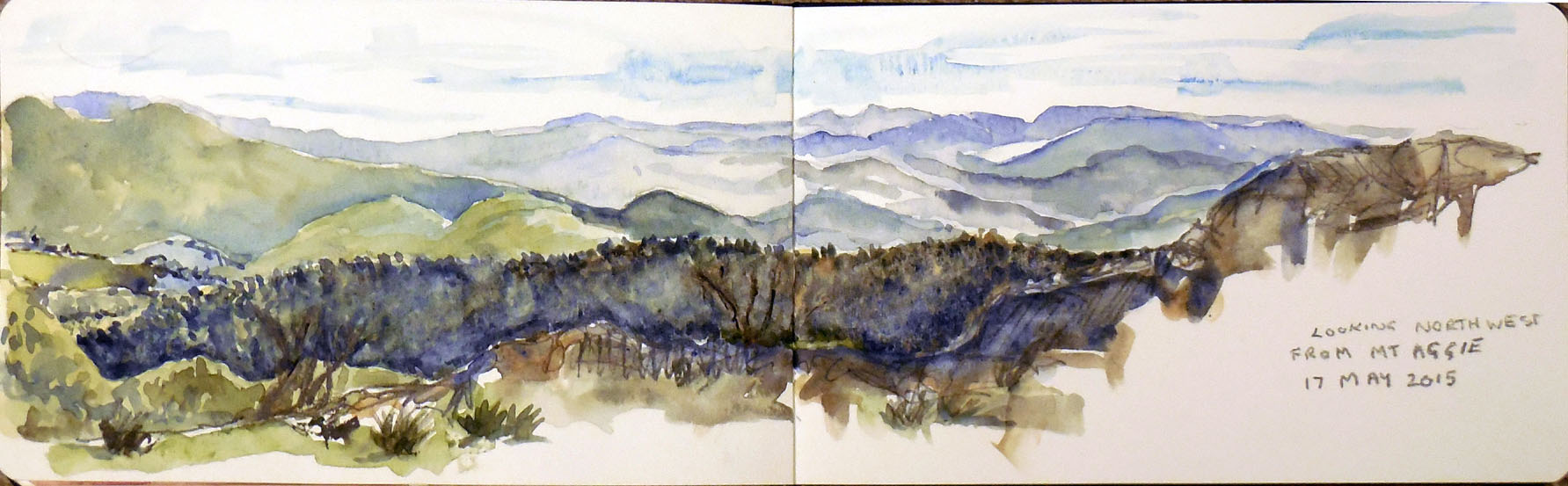
The view to the northwest from Mt Aggie, watercolour and graphite, 17 May 2015
It was a truly magic day. I’ll leave you with a shot of this small paper daisy, one of the last flowers of the season.
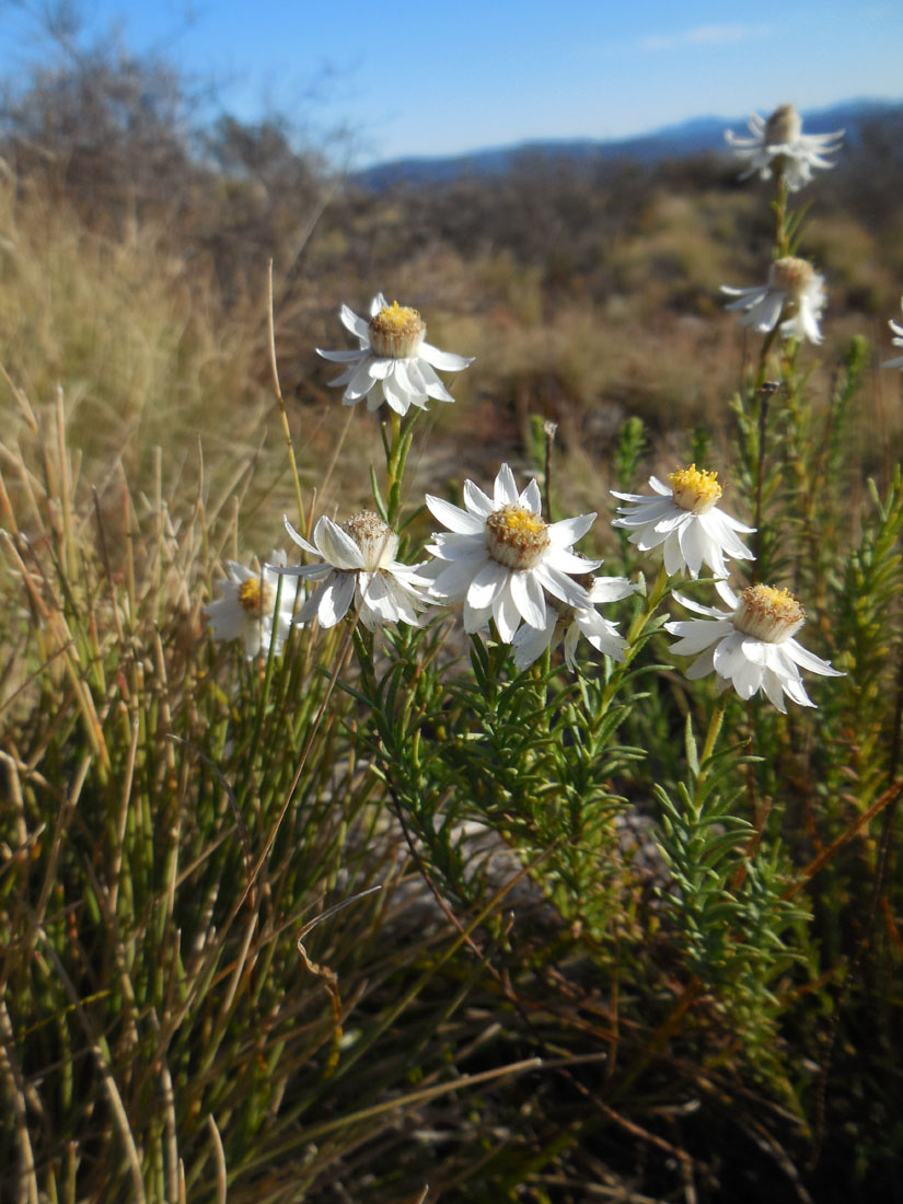
Paper Daisy, Mt Aggie, 17 May 2015
