Early in March this year rangers arrived at the Namadgi National Park visitor information centre to see that a major rockslide had occurred during the night, gouging a pale stripe down three quarters of the mountains’ north-east face.
The landslip looks pretty dramatic close up, but driving around Tuggeranong it is clear that it is even more striking from a distance.

So this weeks exercise involved just that, climbing up Mt Taylor to get a good view of Mt Tennant. I made the following drawing using watercolour pencils.
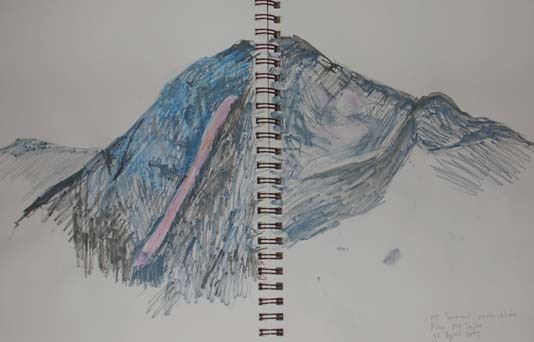
It turns out that you can also see a man-made gash in the side of the Bullen Range, I presume it is a fire trail, quite rusty-orange against the vegetation, compared to the decidedly pink colour of the rockslide on Mt Tennant. This picture takes a ‘slice’ from Mt Gingera, down through Tidbinbilla Nature Reserve and into the forground of the Bullen Range.

